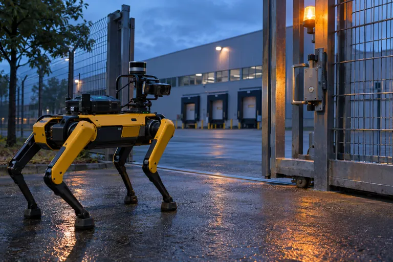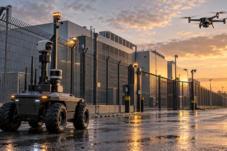
When the drone reaches the scene first
In the first minutes of an alarm, the most important question is often not “what exactly happened?” but who has to go to the scene, what dangers they may face and what resources are worth mobilising. This is where public-safety and facility-protection drones can matter most: they do not replace the patrol officer or the responder, but they can give a picture of the situation before that person arrives, which can improve the first decision.
The expanded Axon–Skydio partnership points the same way. Axon has announced a further $1.2 billion investment in the drone maker Skydio and is expected to receive exclusive public-safety distribution rights in the United States and Canada. The transactions are still subject to customary closing conditions and are expected to close in the fourth quarter of 2026 and the first quarter of 2027. Axon announcement
But the story is not mainly about the size of the investment. It is about how alarm handling could change when the first information from the scene is not a phone call but a live aerial picture assembled from several sensors.
The “drone as first responder” idea
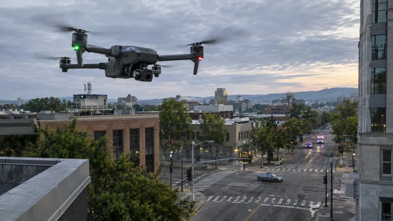
The Drone as First Responder (DFR) model is simple: after an alarm, the drone can launch first while the ground unit is already on its way. Watching the aerial video, the dispatcher or operator can judge sooner whether the event needs a real response or is a false alarm, an accident, a fire, an unauthorised entry or even a person in need of help.
- Alarm
- Drone launch
- Live view
- Human decision
- Ground unit
Authorisation · logging · data handling along the whole chain
In practice this does not mean that the drone “decides” on the response. The decision remains a human task. The value of the technology lies in providing the situational picture needed for that decision faster, from a safer distance and often over a larger area.
At a large site, for example, an intrusion alarm alone says little. It is known which zone triggered, but not necessarily whether the cause is a person, a door left open, maintenance work or a sensor fault. A properly integrated drone can reach the alarmed area quickly and let the operator check the surroundings on camera.
This can reduce unnecessary call-outs, but it is just as important that it can leave the arriving unit better prepared for genuine risks. A lone person moving about, a thermal image suggesting fire, a damaged vehicle and a group attempting entry each call for a different approach.
Live video is more than an extra camera
The advantage of a drone is not only that it adds a camera from above. The aerial viewpoint on its own can remove many blind spots: a large car park, construction site, storage yard, port, rail area or extended industrial site becomes easier to see as a whole.
The real change comes when the camera is not a standalone device but part of the security process. In a well-designed system, the alarm’s event ID, the drone’s live video, the site map, the access-control data and the ground patrol’s communication can all be tied to the same incident.
The dispatcher then does not try to assemble the picture from separate data sources, but sees the available information organised around a single event. The drone acts as the advance scout of the site: it does not replace the CCTV system, intrusion detection or guarding, but connects them with a visual check of what is actually happening.
I looked at the step from an alarm to a verified situation in more detail in my article on 5G drone detection and robot patrols in facility security, which compares two approaches to turning an alarm into an informed human decision.
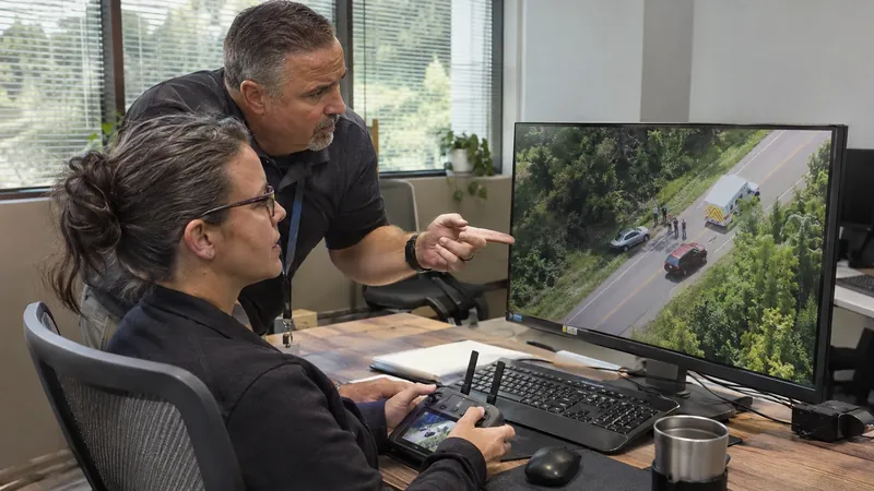
According to Axon’s own announcement, priority response times at agencies deploying Skydio DFR have been reduced by as much as 65 percent, and drones arrived before officers on roughly 80 percent of the calls where they were deployed. Axon announcement (also reported by Security Info Watch). These figures are best treated as company statements: they illustrate the aim of the model, but they do not replace independent performance testing across different environments. Axon’s exclusive distribution rights apply to the U.S. and Canada, so the results cannot simply be transferred to Hungarian or EU conditions.
Flying and reconnaissance are two separate jobs
A drone-based situational picture is reliable only if two different capabilities are present. One is that the aircraft can reach the target area safely. The other is that it can gather interpretable information once there.
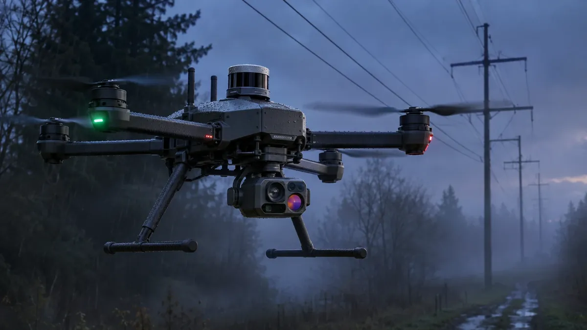
DJI’s new Matrice 5T shows that these functions are increasingly separate, yet appear in the same platform. According to the manufacturer, the drone uses LiDAR, millimetre-wave radar and a vision system to assess obstacles and the flight environment. Their main role is safe navigation: for example around thin wires, building structures and vegetation, or in poor visibility. DJI Matrice 5T specifications
LiDAR measures the geometry of the environment with laser pulses. It can be particularly useful for recognising obstacles that a conventional camera finds harder to separate from the background. Millimetre-wave radar, by contrast, can add supplementary information in fog, dust or weaker visibility, while the vision sensors can support spatial understanding and stable positioning.
An important distinction is that these sensors are not primarily meant to identify an intruder or a missing person. Their job is to let the drone itself fly to the task location more safely and steadily.
Reconnaissance needs other sensors: a visible-light camera, high zoom, a thermal camera, imaging that supports night vision and, in some cases, on-board artificial-intelligence functions. According to the manufacturer’s data, the Matrice 5T has a so-called 1K thermal camera with a native resolution of 1280 × 1024 pixels. It does not replace a good optical image, but it can be a valuable complement in darkness, smoke or a search over a large area. DJI product announcement
Availability is a separate question. DJI notes that the mmWave radar function may be unavailable or restricted in some countries or regions and refers readers to local laws. Its specification page also lists region-dependent radio limits, for example a shorter maximum video transmission distance under CE than under IC standards (20 km against 40 km). The page does not say which functions apply in the EU or in Hungary, so that has to be confirmed with the local dealer before a deployment is planned. DJI Matrice 5T specifications
What can it help decide during a night search?
Imagine a night alarm at an industrial site. Some of the ground cameras give only a limited picture because of poor visibility, while the intrusion detection has registered movement at one section of the fence.
Here the drone’s navigation sensors help it approach the area safely, without hitting wires, trees, buildings or other obstacles. Meanwhile the thermal camera can help find the heat signature of a living being against the dark background. The visible-light or zoom camera matters when the heat source has to be interpreted: is it a person, an animal, a vehicle, a heating piece of plant or something else?
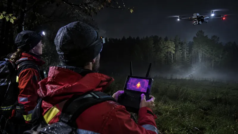
Yet a final conclusion should rarely be drawn from a single sensor. A thermal image shows that something differs in temperature from its surroundings, but on its own it cannot reliably say what it is. A visible-light image may carry more detail, but it can lose its advantage in darkness or fog. Good operator work therefore means comparing several data sources.
The approach is familiar from video analytics as well: the algorithm or the sensor may raise an alert, but classifying the event and deciding the necessary action remain human responsibilities.
Beyond the technology, the operating model decides
A drone becomes a real security tool when it is part of a well-defined process rather than a showpiece. That requires answers to several questions:
- Who may launch the drone, and for which event types?
- Who watches the live video, and who is authorised to decide on an intervention?
- What data enters the video-management system, how long is it retained and who can access it?
- What happens in the event of a communication failure, bad weather, a low battery or a landing fault?
- How does the drone check connect to the existing alarm-handling, access-control and camera workflows?
- What aviation, data-protection and site-specific restrictions apply to operation?
No single product specification answers these questions. When designing the system, the technical capabilities, the site’s risks, the human resources, the data handling and the applicable legal framework have to be examined together.
The communication link and the human decision are also the focus of my article on pairing a drone with a ground robot in a UK infrastructure pilot, which draws design lessons on communications, response and human decisions.
The European and Hungarian regulatory frame
A drone programme in Europe starts with aviation rules, not with the aircraft’s specification. Under Commission Implementing Regulation (EU) 2019/947, EASA distinguishes the open, specific and certified categories. Among the examples of the specific category, EASA lists flights beyond visual line of sight, flights above 120 m, aircraft over 25 kg, and operations in an urban environment with an aircraft over 4 kg or without a class identification label. There the operator must be registered, prepare an operations manual and – unless it uses a standard scenario or holds a light UAS operator certificate – obtain an operational authorisation from the national aviation authority. EASA – specific category
A DFR flight launched from a dock and watched from a control room is by design a beyond-visual-line-of-sight operation, so in my reading it would normally belong to the specific category. This is my own conclusion, not an official position; whether a particular operation qualifies is for the authority to decide.
Hungary adds national rules. Under the Aviation Act (Act XCVII of 1995, section 5(3)), an unmanned aircraft operation over a built-up area – toy aircraft excepted – can use Hungarian airspace only if ad hoc airspace has been designated, with a few statutory exceptions. Aviation Act – National Legislation Database Unmanned state aircraft are covered by separate rules, supervised by the military aviation authority. Government Decree 38/2021 (II. 2.)
The second frame is data protection. Where footage allows people to be identified, the GDPR applies. The EDPB’s guidelines on video devices do not deal with drones specifically, but they point out that systematic monitoring of a publicly accessible area on a large scale calls for a data protection impact assessment (GDPR Article 35(3)(c)), and the principles they set out on legal basis, transparency and storage periods are a useful checklist for a drone programme too. EDPB – Guidelines 3/2019 on video devices
Hungarian security law adds its own limits. Under the Act on personal and property protection and private investigation (Act CXXXIII of 2005, section 30(2)–(3)), a security guard may use an electronic surveillance system only on private property, and such a system cannot be used where observation could violate human dignity, for example in changing rooms or toilets. Act CXXXIII of 2005 – National Legislation Database The Act does not mention drones, so how far it covers a drone camera is a question of legal interpretation for each project. The Hungarian data protection authority (NAIH) published a recommendation on data processing with drones in 2014, before the GDPR; it is useful as background, but not as current law. NAIH – recommendation on drones (2014)
The drone does not intervene; the earlier information does
The Axon–Skydio partnership and the development of multi-sensor reconnaissance drones point in the same direction: in physical security it is increasingly valuable if an interpretable picture of an event exists before the ground unit arrives.
A drone is useful when it reduces uncertainty: when it helps decide whether an alarm is real, which way to go, whether an ambulance, fire service or additional patrol is needed, and what risks to prepare for. The right sensors are not valuable in themselves. LiDAR, radar, thermal camera and optical image work well together when the information supports the dispatcher’s and operator’s decision.
The security drone of the future is therefore unlikely to be simply a “flying camera”. It will more probably be a fast, mobile link in the alarm-handling chain that brings several sensors together.
Sources: Security Info Watch – Axon to Invest $1.2B in Skydio · Axon – official investor announcement · Commercial UAV News – DJI Matrice 5T · DJI Enterprise – Matrice 5T product announcement · DJI Enterprise – Matrice 5T specifications
Legal and regulatory sources: EASA – specific category · Aviation Act (Act XCVII of 1995) · Government Decree 38/2021 (II. 2.) · Act CXXXIII of 2005 · EDPB – Guidelines 3/2019 · NAIH – recommendation on drones (2014)
Last reviewed:
Questions, or an idea to talk through?
Whether it is a security system, the IT network behind it or just a thought on this article, I am happy to hear from you.
Get in touch